The Unicoi Turnpike
The Unicoi Turnpike Trail, once part of the Cherokee homeland, is a historic route that predates written history. It linked Overhill Cherokee towns in Tennessee to settlements in the Carolinas and Georgia and later became a major trade corridor for deerskins and furs, a military route during the French and Indian War and the Revolution, and a toll road for livestock drovers supported by roadside inns and trading stands. Gold discoveries at Coker Creek, the Trail of Tears, and Civil War skirmishes all left their mark on this storied path. Today, the trail invites travelers to explore Monroe County’s deep Cherokee heritage, historic landmarks, and scenic Appalachian landscapes.
For more historical information visit :

The Unicoi Turnpike offers a breathtaking scenic drive through Monroe County, connecting travelers with the deep history and heritage.
TRAVEL TIP:
Highway 360 is a narrow, winding back road that winds through the quiet rural countryside, where cell service can be limited. Be sure to respect the land, fill up on gas beforehand, and plan accordingly—public restrooms and gas stations are only available at the beginning and end of the route in Tellico Plains and Vonore.
Driving Tour
You can drive the Unicoi Turnpike in just about an hour—but why rush? Monroe County is full of historic treasures and scenic stops that are best enjoyed at a leisurely pace. Plan a weekend to truly immerse yourself in this remarkable journey through history.
In Vonore, where you’ll find Fort Loudoun State Historic Park and the Sequoyah Birthplace Museum, two must-visit sites that bring the past to life. Check Fort Loudoun’s Facebook page for historical reenactments—you won’t want to miss them! While in Vonore, take a short detour to the Tellico Blockhouse and the Chota & Tanasi Memorials, where you can reflect on the land’s deep history while enjoying a peaceful picnic with stunning lake views.
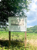
From there, travel along Highway 360 through the historic town of Belltown, the site of the Cane Creek Massacre, and then make your way to Tellico Plains. Stop by the Charles Hall Museum and the Cherohala Skyway Visitor Center for fascinating local history, then grab a bite to eat in charming downtown Tellico Plains.
Next, head to the Coker Creek Welcome Center and follow the Joe Brown Highway, a gravel road perfect for adventurous off-road vehicles. From there, continue your exploration on foot with hiking the Unicoi Turnpike Trail which is located between Doc Rogers Fields Trail and the Unicoi Gap section of the Benton MacKaye Trail. Discover historic archaeological sites along the trail such as Fort Armistead.

Must visit stops along the drive

Hike the Historic Unicoi Turnpike Trail
The Unicoi Turnpike Hiking Trail in the Cherokee National Forest at Coker Creek follows a historic path traveled for centuries. The 2½-mile blue-blazed trail runs between Unicoi Gap and Doc Rogers Fields, passing historic sites such as Fort Armistead which was established in 1800's to protect Cherokee land from prospectors and may have aided a nearby stand garrisoned by the U.S. Army. In 1835, it is also believed that over 3,000 Cherokee people stayed at the fort during the Trail of Tears. More information and maps are available at the Coker Creek Welcome Center.


